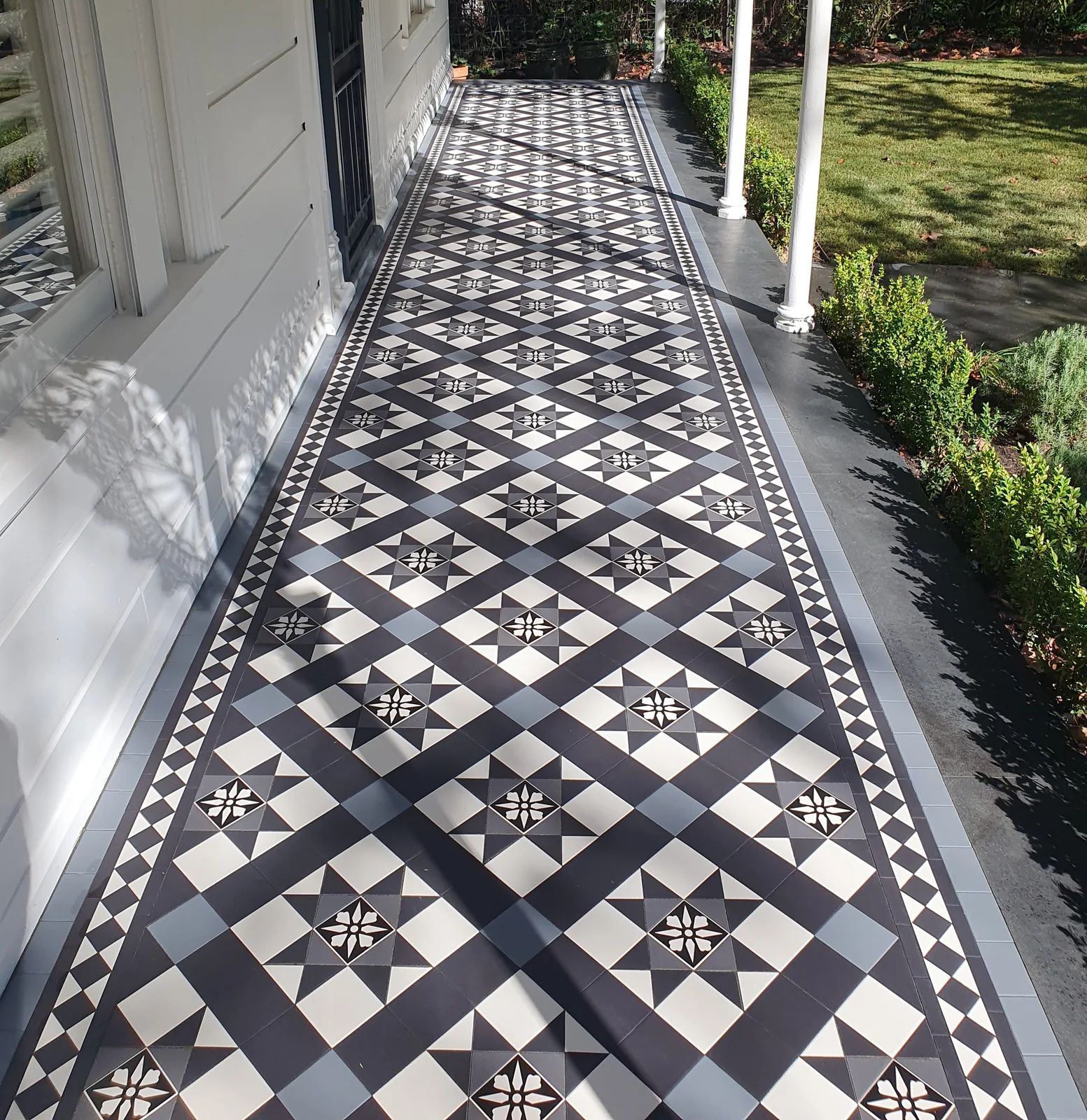
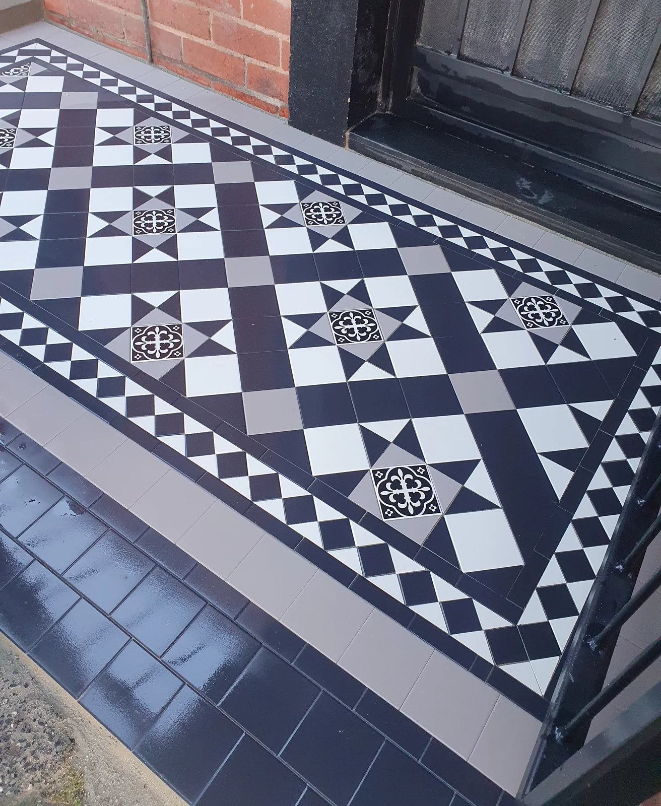
Parkville, VIC
Parkville VIC tessellated tiling
Supply and installation tessellated tiles for the entrance in Parkville, VIC.
Read the projectUse this City of Melbourne area directory to find locality-specific heritage tiling guidance. Melbourne's inner city combines a compact central municipality with distinct neighbourhood settings, from Carlton and East Melbourne to Parkville, Southbank and West Melbourne. Authentic Heritage Tiling Co provides design consultation, tessellated tile supply, installation, restoration and stone bullnose or edging coordination for property owners planning work in this area. Use the locality links below to begin with the right context, then check the property-specific heritage information before changing original fabric.
The City of Melbourne municipality is an inner-metropolitan area of about 37 km2 that includes the central city and shares borders with seven other councils. Its council-recognised neighbourhoods include Carlton, East Melbourne, Parkville, North Melbourne, West Melbourne, Kensington, Docklands, Southbank, South Yarra and the CBD Hoddle Grid. That compact geography does not make every nearby suburb part of the same statutory municipality, so the locality route is best used as a service directory rather than a legal boundary statement.
For a period home, terrace, apartment entry or pathway, the useful starting point is the existing surface and the way the new work will meet thresholds, walls, garden edges and adjoining materials. Design consultation can help consider scale, geometry, border treatment and transitions without assuming that a particular pattern or material belongs to every Melbourne property.
Home and neighbourhood | City of MelbourneOur city | City of Melbourne
The City of Melbourne heritage map can be used to look up a property and review Heritage Overlay information, heritage categories and available Statements of Significance. The council explains that the Heritage Overlay may apply to an individual place or to a defined precinct, and that certain building and works are likely to need a Council planning permit where the overlay applies.
A state-listed place is a separate level of protection. Heritage Victoria states that places and objects on the Victorian Heritage Register are protected by law and that changes require Heritage Victoria approval. These checks are property-specific: a heritage setting or a nearby listed place is not, by itself, proof that every home or every tile repair has the same controls.
Heritage map | City of MelbourneThe Heritage Overlay | City of Melbourne Heritage Owner's GuideState heritage listing | Heritage Victoria
Where original tessellated tiles survive, record their layout, border, colour relationships and condition before selecting replacement work. A restoration assessment can distinguish a local repair from a wider renewal and can consider how retained fabric meets new thresholds, damp-prone edges, stairs or outdoor pathways.
For new work, design consultation can develop a proportionate layout for the property rather than copying a generic period motif. Supply and installation planning should allow the site, access, substrate condition and junctions with stone bullnose or edging to be assessed before the final scope is set.
Heritage map | City of MelbourneThe Heritage Overlay | City of Melbourne Heritage Owner's Guide
No. The City of Melbourne heritage map identifies property-level Heritage Overlay information and heritage categories, while the planning scheme and any applicable state register determine the relevant controls. Check the specific property rather than assuming that a neighbourhood label applies uniformly.
Document the existing pattern, borders, colours, condition and adjoining details first. Then check the property's council heritage information and any applicable Victorian Heritage Register entry before deciding whether the work is repair, selective replacement or new installation.
It can. The City of Melbourne says that certain building and works on a property with a Heritage Overlay are likely to require a Council planning permit. The exact position depends on the property and proposed work, so confirm the applicable planning information before starting.
Treat the route as an operational service-navigation entry and verify the property's actual council and planning context through current official maps.
Share your location, project details and photographs using our enquiry form, or call 0433 932 711.